Geolocate

Forestville topographic map

Click on the map to display elevation.

About this map

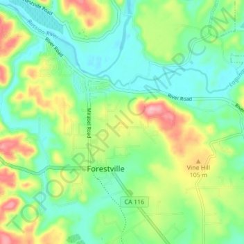
Name: Forestville topographic map, elevation, terrain.

Location: Forestville, Sonoma County, California, United States (38.46338 -122.92021 38.50421 -122.85162)

Average elevation: 57 m

Minimum elevation: 8 m

Maximum elevation: 153 m

Other topographic maps

Click on a map to view its topography, its elevation and its terrain.

Ross

United States > California > Sonoma County > Forestville

Average elevation: 57 m

Gear up for your next adventure:

🔦LED Headtorch - Bright and durable light for night activities
🥾Waterproof Trail Shoes - Shoes designed to handle wet terrain
🧥Waterproof Jacket - Lightweight rain jackets for hiking and outdoor activities
🛁Quick-Dry Microfiber Towel - Space-saving towel that dries rapidly on the move
🧢Beanie Hat - Keep your head warm in cold weather

As an Amazon Associate, this site earns from qualifying purchases at no extra cost to you.