Geolocate

North Jackson topographic map

Click on the map to display elevation.

About this map

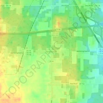
Name: North Jackson topographic map, elevation, terrain.

Location: North Jackson, Mahoning County, Ohio, 44451, United States (41.08013 -80.87717 41.12013 -80.83717)

Average elevation: 311 m

Minimum elevation: 294 m

Maximum elevation: 326 m

Other topographic maps

Click on a map to view its topography, its elevation and its terrain.

Youngstown

United States > Ohio > Mahoning County

Average elevation: 307 m

Canfield

United States > Ohio > Mahoning County

Average elevation: 347 m

Canfield Township

United States > Ohio > Mahoning County

Average elevation: 334 m

Youngstown

United States > Ohio > Mahoning County

Average elevation: 307 m

Struthers

United States > Ohio > Mahoning County

Average elevation: 302 m

Struthers

United States > Ohio > Mahoning County

Average elevation: 302 m

Beloit

United States > Ohio > Mahoning County

Average elevation: 346 m

Canfield

United States > Ohio > Mahoning County

Average elevation: 347 m

Struthers

United States > Ohio > Mahoning County

Average elevation: 302 m

Youngstown

United States > Ohio > Mahoning County

Average elevation: 307 m

Gear up for your next adventure:

🧰Multitool Knife - Compact and versatile tool for outdoor use
💡Solar Camping Lamp - Eco-friendly lighting for campsites
🧥Waterproof Pants - Keep dry during rainy hiking conditions
🔭Outdoor Binoculars - Lightweight binoculars for birdwatching and hiking
🚑Survival Whistle - Signal for help across long distances in mountains

As an Amazon Associate, this site earns from qualifying purchases at no extra cost to you.