Geolocate

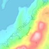
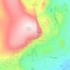
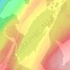
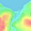
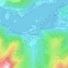
Loch Glass topographic map

Click on the map to display elevation.

About this map

Name: Loch Glass topographic map, elevation, terrain.

Location: Loch Glass, Highland, Scotland, United Kingdom (57.69716 -4.54532 57.73259 -4.45902)

Average elevation: 430 m

Minimum elevation: 213 m

Maximum elevation: 919 m

Other topographic maps

Click on a map to view its topography, its elevation and its terrain.
Aviemore

United Kingdom > Scotland > Highland

Average elevation: 331 m

Loch Lochy

United Kingdom > Scotland > Highland

Average elevation: 363 m

Inverness

United Kingdom > Scotland > Highland

Average elevation: 163 m

Fort William

United Kingdom > Scotland > Highland

Fort William has an oceanic climate (Cfb) with moderate, but generally cool, temperatures and abundant precipitation. In the towns immediate vicinity, there are significant variations in elevation, which leads to some uninhabited areas near the town having a subpolar oceanic climate (Cfc), or, at the absolute…

Average elevation: 122 m
Ben Nevis

United Kingdom > Scotland > Highland

Ben Nevis has a highland (alpine) maritime (oceanic) polar climate (ET climate in the Köppen classification). Ben Nevis's elevation, maritime location and topography frequently lead to cool and cloudy weather conditions, which can pose a danger to ill-equipped walkers. According to the observations carried…

Average elevation: 912 m
Scottish Highlands

United Kingdom > Scotland > Highland

The entire region was covered by ice sheets during the Pleistocene ice ages, save perhaps for a few nunataks. The complex geomorphology includes incised valleys and lochs carved by the action of mountain streams and ice, and a topography of irregularly distributed mountains whose summits have similar heights…

Average elevation: 907 m

Annat

United Kingdom > Scotland > Highland

Average elevation: 152 m

Maryburgh

United Kingdom > Scotland > Highland

Average elevation: 56 m

Old Man of Storr

United Kingdom > Scotland > Highland

Average elevation: 354 m

Tomich

United Kingdom > Scotland > Highland

Average elevation: 218 m

Erchless Castle

United Kingdom > Scotland > Highland > Struy

Average elevation: 131 m

Loch Fannich

United Kingdom > Scotland > Highland

Average elevation: 463 m

Eriboll

United Kingdom > Scotland > Highland

Average elevation: 92 m

Newtonmore

United Kingdom > Scotland > Highland

Newtonmore is located within the Cairngorms National Park, approximately 3 miles (5 km) southwest of Kingussie and 15 miles (24 km) southwest of Aviemore. It is on the northeastern bank of the River Spey, between the River Calder and the Allt Lairaidh, at an altitude of approximately 250 metres (820 ft).

Average elevation: 283 m
Achmelvich

United Kingdom > Scotland > Highland

Average elevation: 58 m

Kylesku

United Kingdom > Scotland > Highland

Average elevation: 82 m

`Neist Point

United Kingdom > Scotland > Highland

Average elevation: 7 m

North Ballachulish

United Kingdom > Scotland > Highland

Average elevation: 152 m

Quiraing

United Kingdom > Scotland > Highland

Average elevation: 298 m

Kilmore

United Kingdom > Scotland > Highland > Ferindonald

Average elevation: 61 m

Big Sand

United Kingdom > Scotland > Highland > Big Sand

Average elevation: 37 m

Tornagrain

United Kingdom > Scotland > Highland > Tornagrain

Average elevation: 51 m

Loch Teth

United Kingdom > Scotland > Highland

Average elevation: 94 m

Rubha Reidh

United Kingdom > Scotland > Highland > Melvaig

Average elevation: 32 m

Lentran

United Kingdom > Scotland > Highland > Inchmore

Average elevation: 54 m

Loch Hourn

United Kingdom > Scotland > Highland

Average elevation: 283 m
River Drynoch

United Kingdom > Scotland > Highland > Satran

Average elevation: 175 m

Struanmor

United Kingdom > Scotland > Highland > Struan

Average elevation: 40 m

Balgown

United Kingdom > Scotland > Highland > Struan

Average elevation: 58 m

Invercassley

United Kingdom > Scotland > Highland > Rosehall

Average elevation: 43 m

Loch Ossian

United Kingdom > Scotland > Highland

Average elevation: 538 m

Coylumbridge

United Kingdom > Scotland > Highland > Aviemore

Average elevation: 262 m

Loch Ashie

United Kingdom > Scotland > Highland > Inverness

Average elevation: 228 m

Loch Saine

United Kingdom > Scotland > Highland

Average elevation: 80 m

Lochcarron

United Kingdom > Scotland > Highland

Average elevation: 67 m

Elphin

United Kingdom > Scotland > Highland

Average elevation: 167 m

Duncansby Head

United Kingdom > Scotland > Highland

Average elevation: 9 m

Glasphein

United Kingdom > Scotland > Highland > Glendale

Average elevation: 104 m

Loch Cuithir

United Kingdom > Scotland > Highland

Average elevation: 245 m

Beinn Eighe

United Kingdom > Scotland > Highland

Beinn Eighe (Scottish Gaelic for 'file mountain') is a mountain massif in the Torridon area of Wester Ross in the Northwest Highlands of Scotland. Lying south of Loch Maree, it forms a long ridge with many spurs and summits, two of which are classified as Munros: Ruadh-stac Mòr at 1,010 m (3,314 ft) and…

Average elevation: 633 m

Quinag

United Kingdom > Scotland > Highland

Average elevation: 368 m

Loch Broom

United Kingdom > Scotland > Highland > Rhue

Average elevation: 15 m

Glen Affric

United Kingdom > Scotland > Highland > Tomich

Average elevation: 504 m

Jules's

United Kingdom > Scotland > Highland > Aviemore

Average elevation: 363 m

Raddery

United Kingdom > Scotland > Highland > Fortrose

Average elevation: 129 m

Corpach

United Kingdom > Scotland > Highland

Average elevation: 83 m

Ardnarff

United Kingdom > Scotland > Highland

Average elevation: 156 m

Whitebridge

United Kingdom > Scotland > Highland

Average elevation: 223 m

Langdale

United Kingdom > Scotland > Highland

Average elevation: 115 m

Davochfin

United Kingdom > Scotland > Highland > Dornoch

Average elevation: 13 m

Melvaig

United Kingdom > Scotland > Highland

Average elevation: 90 m

Strathpeffer

United Kingdom > Scotland > Highland

It lies in a strath 5 miles (8 km) west of Dingwall, with the elevation ranging from 60 to 120 m (200 to 400 ft) above sea level. Sheltered on the west and north, it has a comparatively dry and warm climate.

Average elevation: 127 m
Mellon Charles

United Kingdom > Scotland > Highland

Average elevation: 30 m

Invermoriston

United Kingdom > Scotland > Highland

Average elevation: 212 m

Sgùrr Alasdair

United Kingdom > Scotland > Highland

Average elevation: 576 m

Glencoe

United Kingdom > Scotland > Highland

Average elevation: 114 m

Avoch

United Kingdom > Scotland > Highland

Average elevation: 50 m

Scotscalder

United Kingdom > Scotland > Highland

Average elevation: 72 m

Wick

United Kingdom > Scotland > Highland

Average elevation: 20 m

Kingussie

United Kingdom > Scotland > Highland

Average elevation: 338 m

Thurso

United Kingdom > Scotland > Highland

Average elevation: 25 m

Lairg

United Kingdom > Scotland > Highland

Average elevation: 129 m

Insh

United Kingdom > Scotland > Highland

Average elevation: 275 m

Lyth

United Kingdom > Scotland > Highland

Average elevation: 29 m

Caol

United Kingdom > Scotland > Highland

Average elevation: 38 m

Glasnakille

United Kingdom > Scotland > Highland

Average elevation: 39 m

Ballachulish

United Kingdom > Scotland > Highland

Average elevation: 160 m

Clachtoll

United Kingdom > Scotland > Highland

Average elevation: 38 m

Brae Roy Lodge

United Kingdom > Scotland > Highland

Average elevation: 371 m

Grampian Mountains

United Kingdom > Scotland > Highland

Average elevation: 775 m

Staffin

United Kingdom > Scotland > Highland

Average elevation: 42 m

Dounreay

United Kingdom > Scotland > Highland

Average elevation: 36 m

Inverinate

United Kingdom > Scotland > Highland

Average elevation: 186 m

Tongue

United Kingdom > Scotland > Highland

Average elevation: 91 m

Knockdee

United Kingdom > Scotland > Highland

Average elevation: 66 m

North Watten

United Kingdom > Scotland > Highland

Average elevation: 51 m

Poolewe

United Kingdom > Scotland > Highland

Average elevation: 58 m

Altnaharra

United Kingdom > Scotland > Highland

Average elevation: 126 m

Forsinard

United Kingdom > Scotland > Highland

Average elevation: 171 m

Fearnmore

United Kingdom > Scotland > Highland

Average elevation: 22 m

Milovaig

United Kingdom > Scotland > Highland

Average elevation: 72 m

Sgùrr nan Gillean

United Kingdom > Scotland > Highland

Average elevation: 496 m

Tarvie

United Kingdom > Scotland > Highland

Average elevation: 135 m

The Storr

United Kingdom > Scotland > Highland

Average elevation: 396 m

Halkirk

United Kingdom > Scotland > Highland

Average elevation: 49 m

Foyers

United Kingdom > Scotland > Highland

Average elevation: 124 m

Spean Bridge

United Kingdom > Scotland > Highland

Average elevation: 141 m

Gillock

United Kingdom > Scotland > Highland > Wick

Average elevation: 22 m

Grantown-on-Spey

United Kingdom > Scotland > Highland

Average elevation: 271 m

Farrmheall

United Kingdom > Scotland > Highland

Average elevation: 281 m

Laide

United Kingdom > Scotland > Highland

Average elevation: 47 m

Gartymore

United Kingdom > Scotland > Highland > Portgower

Average elevation: 94 m

Gear up for your next adventure:

🧴Outdoor Sunscreen - High SPF protection for high-altitude UV exposure
🧣Evaporative Cooling Towel - Beat the heat during intense summer climbs
🥾Hiking Shoes - Durable and comfortable shoes for trail hiking
🥾Hiking Shorts - Breathable shorts suitable for summer hikes
🥾Waterproof Hiking Boots - Boots keeping your feet dry in wet conditions

As an Amazon Associate, this site earns from qualifying purchases at no extra cost to you.