
Spry Lake topographic map
Click on the map to display elevation.
About this map
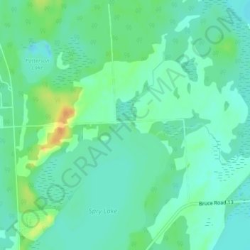
Name: Spry Lake topographic map, elevation, terrain.
Average elevation: 192 m
Minimum elevation: 182 m
Maximum elevation: 214 m
Bruce County trails, hiking, mountain biking, running and outdoor activities
Other topographic maps
Click on a map to view its topography, its elevation and its terrain.
Sauble Falls Provincial Park
Canada > Ontario > Bruce County > Chief's Point > Sauble Falls
Average elevation: 191 m