Geolocate

Brockton topographic maps

Click on a map to view its topography, its elevation and its terrain.

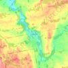
Walkerton

Canada > Ontario > Bruce County > Brockton

Average elevation: 286 m

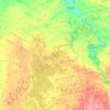
Greenock

Canada > Ontario > Bruce County > Brockton

Average elevation: 272 m

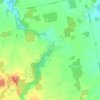
Cargill

Canada > Ontario > Bruce County > Brockton

Average elevation: 269 m

Gear up for your next adventure:

🛰️Satellite Messenger - Emergency communication for areas with no cell service
🔦LED Headlamp - Hands-free lighting for early morning starts or late finishes
⛺Camping Tent - Weather-resistant tents suitable for 2 to 6 people
🌬️Windproof Camp Stove - Efficient cooking even on exposed mountain peaks
🧶550 Survival Paracord - Versatile utility cord for emergency repairs and rigging

As an Amazon Associate, this site earns from qualifying purchases at no extra cost to you.