
South Bruce topographic map
Click on the map to display elevation.
About this map
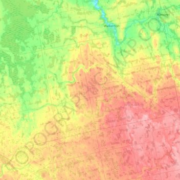
Name: South Bruce topographic map, elevation, terrain.
Location: South Bruce, Bruce County, Ontario, Canada (43.92732 -81.40740 44.12436 -80.98919)
Average elevation: 315 m
Minimum elevation: 238 m
Maximum elevation: 399 m
Bruce County trails, hiking, mountain biking, running and outdoor activities
Other topographic maps
Click on a map to view its topography, its elevation and its terrain.
Lion's Head Provincial Nature Reserve
Canada > Ontario > Bruce County > Lion's Head
Average elevation: 206 m