
Whale Cove topographic map
Click on the map to display elevation.
About this map
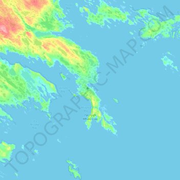
Name: Whale Cove topographic map, elevation, terrain.
Location: Whale Cove, Kivalliq Region, Nunavut, X0C 0J0, Canada (62.11696 -93.22502 62.35694 -92.31666)
Average elevation: 5 m
Minimum elevation: -1 m
Maximum elevation: 78 m
Kivalliq Region trails, hiking, mountain biking, running and outdoor activities
Other topographic maps
Click on a map to view its topography, its elevation and its terrain.
Yathkyed Lake
Canada > Nunavut > Kivalliq Region
It is part of the Hearne Domain, Western Churchill province of the Churchill craton, which is the northwest section of the Canadian Shield. According to the Atlas of Canada the geographical centre of the country lies just south of the lake at 62°24′N 096°28′W / 62.400°N 96.467°W / 62.400;…
Average elevation: 142 m