Geolocate

Chesterfield Inlet topographic map

Click on the map to display elevation.

About this map

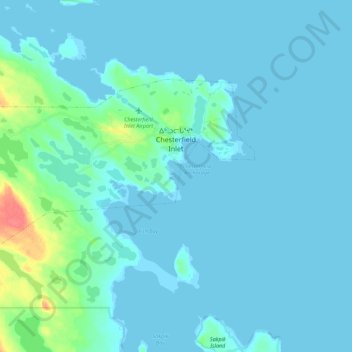
Name: Chesterfield Inlet topographic map, elevation, terrain.

Location: Chesterfield Inlet, Kivalliq Region, Nunavut, Canada (63.30189 -90.88234 63.35675 -90.66021)

Average elevation: 5 m

Minimum elevation: -1 m

Maximum elevation: 50 m

Kivalliq Region trails, hiking, mountain biking, running and outdoor activities

Other topographic maps

Click on a map to view its topography, its elevation and its terrain.

Whale Cove

Canada > Nunavut > Kivalliq Region

Average elevation: 5 m

Baker Lake

Canada > Nunavut > Kivalliq Region

Average elevation: 50 m

Nunalla

Canada > Nunavut > Kivalliq Region

Average elevation: 1 m

Gear up for your next adventure:

💡LED Camping Lantern - Illuminate your campsite with long-lasting lanterns
🛰️Satellite Messenger - Emergency communication for areas with no cell service
🧢Outdoor Visor - Breathable visor for sunny hikes
🧣Merino Neck Gaiter - Protects against wind, sun, and cold at high altitudes
🎒Fully Waterproof Backpack - Total protection for photography gear and electronics

As an Amazon Associate, this site earns from qualifying purchases at no extra cost to you.