Geolocate

Arlington topographic map

Interactive map

Click on the map to display elevation.

About this map

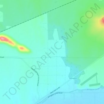
Name: Arlington topographic map, elevation, terrain.

Location: Arlington, Maricopa County, Arizona, United States (33.31453 -112.79013 33.35748 -112.76192)

Average elevation: 261 m

Minimum elevation: 236 m

Maximum elevation: 369 m

Other topographic maps

Click on a map to view its topography, its elevation and its terrain.

Tempe

United States > Arizona > Maricopa County

Tempe is generally flat, except for Tempe Butte or Hayden Butte (generally known as A-Mountain for Arizona State University's "A" logo located on its south face), located next to Sun Devil Stadium, Twin Buttes and Bell Butte on the western edge of Tempe, and the buttes within Papago Park at northwest corner of…

Average elevation: 370 m

Fountain Hills

United States > Arizona > Maricopa County

Fountain Hills is in eastern Maricopa County, on the eastern edge of the Phoenix urbanized area. It is 31 miles (50 km) northeast of downtown Phoenix and sits on the east side of the south end of the McDowell Mountains. According to the U.S. Census Bureau, the town has a total area of 20.4 square miles (53…

Average elevation: 503 m

Buckeye

United States > Arizona > Maricopa County

Average elevation: 396 m

Chandler

United States > Arizona > Maricopa County

Average elevation: 372 m

El Mirage

United States > Arizona > Maricopa County

Average elevation: 352 m

Gilbert

United States > Arizona > Maricopa County

Average elevation: 383 m

New River

United States > Arizona > Maricopa County

Average elevation: 647 m

Citrus Park

United States > Arizona > Maricopa County

Average elevation: 360 m

Gila Bend

United States > Arizona > Maricopa County

According to the United States Census Bureau, the town has a total area of 64.4 square miles (167 km2), all of it land.[2] Situated at 735 feet (224 m) above sea level, Gila Bend has the lowest elevation of any city in Maricopa County and in Greater Phoenix overall.[19]

Average elevation: 257 m

Phoenix

United States > Arizona > Maricopa County > Phoenix

Phoenix is in the south-central portion of Arizona; about halfway between Tucson to the southeast and Flagstaff to the north, in the southwestern United States. By car, the city is approximately 150 miles (240 kilometers) north of the US–Mexico border at Sonoyta and 180 mi (290 km) north of the border at…

Average elevation: 368 m

Chandler

United States > Arizona > Maricopa County > Chandler

Average elevation: 386 m

Peoria

United States > Arizona > Maricopa County > Peoria

Average elevation: 366 m