Geolocate

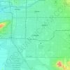
Chandler topographic maps

Click on a map to view its topography, its elevation and its terrain.

Chandler

United States > Arizona > Maricopa County > Chandler

Average elevation: 386 m

Gear up for your next adventure:

🧣Merino Neck Gaiter - Protects against wind, sun, and cold at high altitudes
🥽Outdoor Goggles - Protective eyewear for outdoor activities
⛺Camping Tent - Weather-resistant tents suitable for 2 to 6 people
🔥Camping Stove - Portable stoves to cook outdoors with ease
🥾Trail Running Boots - Durable shoes designed for trail running

As an Amazon Associate, this site earns from qualifying purchases at no extra cost to you.