Geolocate

Peoria topographic map

Click on the map to display elevation.

About this map

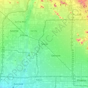
Name: Peoria topographic map, elevation, terrain.

Location: Peoria, Maricopa County, Arizona, 85345, United States (33.42061 -112.39729 33.74061 -112.07729)

Average elevation: 366 m

Minimum elevation: 286 m

Maximum elevation: 668 m

Gear up for your next adventure:

🧰Survival Kit - Essential gear for emergencies in the wilderness
🥾Hiking Gaiters - Protect legs and shoes from mud, snow, and debris
Family Camping Tent - Spacious tent suitable for family camping trips
🧴Insect Repellent - Protect yourself from bugs during outdoor adventures
🧢Sun Protection Cap - Breathable cap to protect from sun exposure

As an Amazon Associate, this site earns from qualifying purchases at no extra cost to you.