Geolocate

El Mirage topographic map

Click on the map to display elevation.

About this map

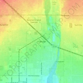
Name: El Mirage topographic map, elevation, terrain.

Location: El Mirage, Maricopa County, Arizona, 85335, United States (33.57303 -112.36449 33.65303 -112.28449)

Average elevation: 352 m

Minimum elevation: 328 m

Maximum elevation: 381 m

Other topographic maps

Click on a map to view its topography, its elevation and its terrain.

Gilbert

United States > Arizona > Maricopa County

Average elevation: 383 m

Estrella

United States > Arizona > Maricopa County > Goodyear

Average elevation: 324 m

Arlington

United States > Arizona > Maricopa County

Average elevation: 261 m

Gila Bend

United States > Arizona > Maricopa County

According to the United States Census Bureau, the town has a total area of 64.4 square miles (167 km2), all of it land.[2] Situated at 735 feet (224 m) above sea level, Gila Bend has the lowest elevation of any city in Maricopa County and in Greater Phoenix overall.[19]

Average elevation: 257 m

Gear up for your next adventure:

🧤Thermal Hiking Gloves - Grip-enhanced gloves for cold-weather altitude trekking
🥾Approach Boots - Comfortable boots for hiking and climbing approaches
🥾Mountaineering Boots - Supportive boots for climbing and high-altitude hiking
🐕Hiking Dog Pack - Let your canine companion carry their own water and food
👟Sport Hiking Sandals - Breathable footwear for water crossings and camp rest

As an Amazon Associate, this site earns from qualifying purchases at no extra cost to you.