
Macerata topographic map
Click on the map to display elevation.
About this map
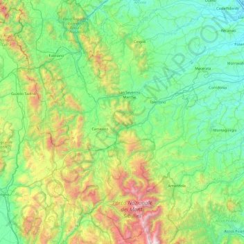
Name: Macerata topographic map, elevation, terrain.
Location: Macerata, Marche, Italy (42.83185 12.82965 43.47394 13.74328)
Average elevation: 562 m
Minimum elevation: 4 m
Maximum elevation: 2,436 m
Other topographic maps
Click on a map to view its topography, its elevation and its terrain.