Geolocate

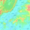
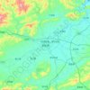
Xinyi City topographic map

Click on the map to display elevation.

About this map
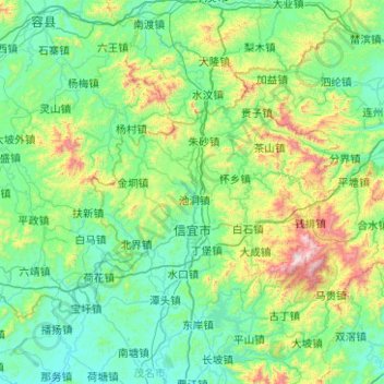
Name: Xinyi City topographic map, elevation, terrain.

Location: Xinyi City, Maoming City, Guangdong Province, China (22.18799 110.67824 22.70701 111.67826)

Average elevation: 299 m

Minimum elevation: 29 m

Maximum elevation: 1,676 m

Other topographic maps

Click on a map to view its topography, its elevation and its terrain.
Tangping

China > Guangdong Province

Average elevation: 34 m

Leizhou

China > Guangdong Province

Average elevation: 15 m

Yunan

China > Guangdong Province > Yunan County

Average elevation: 135 m

Silun

China > Guangdong Province > Luoding

Average elevation: 191 m

Du Village

China > Guangdong Province > Zhaoqing City

Average elevation: 96 m

Kaiping

China > Guangdong Province

Average elevation: 23 m

Nim Tsuen

China > Guangdong Province > Xinxing County > Rencun

Average elevation: 65 m

Liantan

China > Guangdong Province > Yunan County

Average elevation: 94 m

Yangchun

China > Guangdong Province > Yangchun

Average elevation: 112 m

Jinji

China > Guangdong Province > Luoding

Average elevation: 185 m

长乐村

China > Guangdong Province

Average elevation: 22 m

坡村

China > Guangdong Province > Gaozhou City > Maoming City

Average elevation: 74 m

Pingtang

China > Guangdong Province > Luoding

Average elevation: 131 m

平田村

China > Guangdong Province > Xinyi City

Average elevation: 206 m

Shenzhen

China > Guangdong Province > Shenzhen

Average elevation: 85 m

Zhongshan

China > Guangdong Province > Zhongshan

Average elevation: 26 m

Gear up for your next adventure:

🥾Approach Shoes - Shoes designed for climbing approaches and rugged trails
🧥Ultralight Puffy Jacket - Maximum warmth that packs down to the size of an orange
🥾Trail Hiking Boots - Supportive boots for rough trails
🥾Lightweight Hiking Shoes - Comfortable shoes for day hikes
🛶Canoe Life Vest - Safety vest for water sports

As an Amazon Associate, this site earns from qualifying purchases at no extra cost to you.