Geolocate

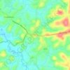
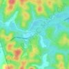
Nellarachal topographic map

Click on the map to display elevation.

About this map

Name: Nellarachal topographic map, elevation, terrain.

Location: Nellarachal, Sulthanbathery, Wayanad District, Kerala, India (11.60135 76.17809 11.62585 76.19512)

Average elevation: 781 m

Minimum elevation: 745 m

Maximum elevation: 989 m

Other topographic maps

Click on a map to view its topography, its elevation and its terrain.
Kuruva Island

India > Kerala > Sulthanbathery

Average elevation: 733 m

Sultan Bathery

India > Kerala > Sulthanbathery

Sulthan Bathery is located at 11°40′N 76°17′E / 11.67°N 76.28°E / 11.67; 76.28. It has an average elevation of 907 m (2,976 ft).

Average elevation: 876 m
Muthanga

India > Kerala > Sulthanbathery

Average elevation: 866 m

Koliyadi

India > Kerala > Sulthanbathery

Average elevation: 886 m

Kenichira

India > Kerala > Sulthanbathery

Average elevation: 770 m

Nadavayal

India > Kerala > Sulthanbathery

Average elevation: 751 m

Ambalavayal

India > Kerala > Sulthanbathery

Average elevation: 880 m

Meenangadi

India > Kerala > Sulthanbathery

Average elevation: 760 m

Kolagappara

India > Kerala > Sulthanbathery

Average elevation: 795 m

Pazhoor

India > Kerala > Sulthanbathery

Average elevation: 881 m

Pulpally

India > Kerala > Sulthanbathery

Average elevation: 781 m

Ambalavayal

India > Kerala > Sulthanbathery

Average elevation: 880 m

Sultan Bathery

India > Kerala > Sulthanbathery

Sulthan Bathery is located at 11°40′N 76°17′E / 11.67°N 76.28°E / 11.67; 76.28. It has an average elevation of 907 m (2,976 ft).

Average elevation: 876 m

Meenangadi

India > Kerala > Sulthanbathery

Average elevation: 760 m

Paplassery

India > Kerala > Sulthanbathery

Average elevation: 795 m

Sultan Bathery

India > Kerala > Sulthanbathery

Sultan Bathery is located at 11°40′N 76°17′E / 11.67°N 76.28°E / 11.67; 76.28, on the Kozhikode–Kollegal National Highway (NH 766) 97 kilometers from Kozhikode. It is 114 km from Mysore and about 100 km from Ooty (Udagamandalam). It is also connected with Nilambur. It has an average…

Average elevation: 876 m

Muthanga

India > Kerala > Sulthanbathery

Average elevation: 866 m

Gear up for your next adventure:

🦶Anti-Blister Balm - Prevents friction and hotspots during long ascents
🥾All-Terrain Hiking Boots - Versatile boots for varied hiking conditions
🧦Hiking Socks - Moisture-wicking and comfortable socks for long hikes
💧Hydration Bladder - Hands-free hydration solution for long treks
🦶Hiking Shoe Insoles - Added support for high arches and long days on feet

As an Amazon Associate, this site earns from qualifying purchases at no extra cost to you.