Geolocate

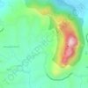
Meenangadi topographic map

Click on the map to display elevation.

About this map

Name: Meenangadi topographic map, elevation, terrain.

Location: Meenangadi, Sulthanbathery, Wayanad, Kerala, 673591, India (11.63947 76.14684 11.67947 76.18684)

Average elevation: 760 m

Minimum elevation: 731 m

Maximum elevation: 815 m

Other topographic maps

Click on a map to view its topography, its elevation and its terrain.

Seethamount

India > Kerala > Sulthanbathery > Kabanigiri

Average elevation: 731 m

Edakkal

India > Kerala > Sulthanbathery > Ambalavayal

Average elevation: 927 m

Kuruva Island

India > Kerala > Sulthanbathery

Average elevation: 733 m

Kenichira

India > Kerala > Sulthanbathery

Average elevation: 788 m

Sulthan Bathery

India > Kerala > Sulthanbathery > Sultan Bathery

Average elevation: 873 m

Marakavu

India > Kerala > Sulthanbathery > Pulpally

Average elevation: 769 m

Nellarachal

India > Kerala > Sulthanbathery

Average elevation: 781 m

Vadakkanad

India > Kerala > Sulthanbathery

Average elevation: 896 m

Kalluvayal

India > Kerala > Sulthanbathery > Pulpally

Average elevation: 816 m

Kalluvayal

India > Kerala > Sulthanbathery > Pulpally

Average elevation: 816 m

Poothadi

India > Kerala > Sulthanbathery

Average elevation: 742 m

Sulthan Bathery

India > Kerala > Sulthanbathery > Sultan Bathery

Average elevation: 873 m

Gear up for your next adventure:

🗺️Topographic Maps - Detailed maps to explore trails, mountains, and wilderness areas
💡LED Headlamp - Hands-free illumination for night hiking and camping
🧥Waterproof Pants - Keep dry during rainy hiking conditions
❄️Traction Ice Cleats - Slip-on spikes for icy trails and winter hiking
🥾Mountain Hiking Shoes - Shoes with superior grip for mountainous terrain

As an Amazon Associate, this site earns from qualifying purchases at no extra cost to you.