Geolocate

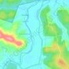
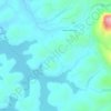
Kolagappara topographic map

Click on the map to display elevation.

About this map

Name: Kolagappara topographic map, elevation, terrain.

Location: Kolagappara, Sulthanbathery, Wayanad, Kerala, 673591, India (11.65326 76.19446 11.65336 76.19456)

Average elevation: 795 m

Minimum elevation: 750 m

Maximum elevation: 974 m

Other topographic maps

Click on a map to view its topography, its elevation and its terrain.

Seethamount

India > Kerala > Sulthanbathery > Kabanigiri

Average elevation: 731 m

Kuruva Island

India > Kerala > Sulthanbathery

Average elevation: 733 m

Kenichira

India > Kerala > Sulthanbathery

Average elevation: 788 m

Sulthan Bathery

India > Kerala > Sulthanbathery > Sultan Bathery

Average elevation: 873 m

Marakavu

India > Kerala > Sulthanbathery > Pulpally

Average elevation: 769 m

Nellarachal

India > Kerala > Sulthanbathery

Average elevation: 781 m

Vadakkanad

India > Kerala > Sulthanbathery

Average elevation: 896 m

Edakkal

India > Kerala > Sulthanbathery > Ambalavayal

Average elevation: 927 m

Kalluvayal

India > Kerala > Sulthanbathery > Pulpally

Average elevation: 816 m

Kalluvayal

India > Kerala > Sulthanbathery > Pulpally

Average elevation: 816 m

Poothadi

India > Kerala > Sulthanbathery

Average elevation: 742 m

Sulthan Bathery

India > Kerala > Sulthanbathery > Sultan Bathery

Average elevation: 873 m

Gear up for your next adventure:

🪑Insulated Seat Pad - Protect your seat from cold rocks and wet logs
🧥Waterproof Jacket - Lightweight rain jackets for hiking and outdoor activities
🧦Hiking Liner Socks - Thin base layer to prevent friction and blisters
🥾Trail Hiking Shoes - Durable shoes designed for rugged trails
🧢Hiking Hat - Sun-protective and breathable hats for long treks

As an Amazon Associate, this site earns from qualifying purchases at no extra cost to you.