
Ogilvie Ridge topographic map
Click on the map to display elevation.
About this map
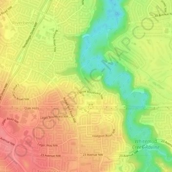
Name: Ogilvie Ridge topographic map, elevation, terrain.
Average elevation: 673 m
Minimum elevation: 629 m
Maximum elevation: 704 m
Division No. 11 trails, hiking, mountain biking, running and outdoor activities
Other topographic maps
Click on a map to view its topography, its elevation and its terrain.
Louise McKinney Riverfront Park
Canada > Alberta > Division No. 11 > Edmonton
Average elevation: 647 m