Geolocate

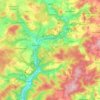
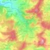
Oberehe topographic map

Click on the map to display elevation.

About this map

Name: Oberehe topographic map, elevation, terrain.

Location: Oberehe, Oberehe-Stroheich, Gerolstein, Landkreis Vulkaneifel, Rijnland-Palts, Duitsland (50.25847 6.75094 50.29847 6.79094)

Average elevation: 520 m

Minimum elevation: 422 m

Maximum elevation: 637 m

Other topographic maps

Click on a map to view its topography, its elevation and its terrain.

Reuth

Duitsland > Rijnland-Palts > Landkreis Vulkaneifel

Average elevation: 588 m

Daun

Duitsland > Rijnland-Palts > Landkreis Vulkaneifel

Average elevation: 485 m

Esch

Duitsland > Rijnland-Palts > Landkreis Vulkaneifel

Average elevation: 528 m

Daun

Duitsland > Rijnland-Palts > Landkreis Vulkaneifel

Average elevation: 485 m

Kopp

Duitsland > Rijnland-Palts > Landkreis Vulkaneifel

Average elevation: 485 m

54587

Duitsland > Rijnland-Palts > Landkreis Vulkaneifel > Birgel

Average elevation: 476 m

Salm

Duitsland > Rijnland-Palts > Landkreis Vulkaneifel

Average elevation: 528 m

Nohn

Duitsland > Rijnland-Palts > Landkreis Vulkaneifel

Average elevation: 439 m

Gear up for your next adventure:

🥾Durable Hiking Shoes - Long-lasting shoes for frequent hiking
🌡️Emergency Mylar Blankets - Compact thermal protection for unexpected nights outdoors
🥾Light Trekking Boots - Supportive boots for multi-day treks
🥾Approach Shoes - Shoes designed for climbing approaches and rugged trails
🎒Hiking Backpack - Lightweight and ergonomic backpacks for day hikes or multi-day treks

As an Amazon Associate, this site earns from qualifying purchases at no extra cost to you.