Geolocate

Kelberg topographic map

Click on the map to display elevation.

About this map
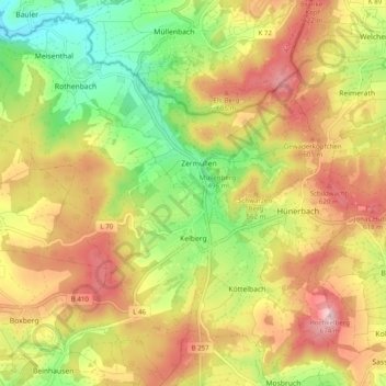
Name: Kelberg topographic map, elevation, terrain.

Location: Kelberg, Landkreis Vulkaneifel, Rhineland-Palatinate, 53539, Germany (50.26345 6.85917 50.32421 6.95749)

Average elevation: 527 m

Minimum elevation: 393 m

Maximum elevation: 660 m

Other topographic maps

Click on a map to view its topography, its elevation and its terrain.
Gear up for your next adventure:

🚲Heavy Duty Bike Lock - Secure your bike at the trailhead or during stops
💡Compact LED Flashlight - Powerful and portable flashlight for outdoor use
🔦LED Headtorch - Bright and durable light for night activities
🏕️Camping Hammock - Integrated protection for sleeping between trees
🛶Kayak Accessories - Essential gear for safe and fun kayaking adventures

As an Amazon Associate, this site earns from qualifying purchases at no extra cost to you.