Geolocate

Mürlenbach topographic map

Click on the map to display elevation.

About this map
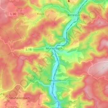
Name: Mürlenbach topographic map, elevation, terrain.

Location: Mürlenbach, Gerolstein, Landkreis Vulkaneifel, Rhineland-Palatinate, Germany (50.12732 6.54843 50.16442 6.67221)

Average elevation: 474 m

Minimum elevation: 302 m

Maximum elevation: 627 m

Other topographic maps

Click on a map to view its topography, its elevation and its terrain.
Gear up for your next adventure:

🧭GPS Outdoor Watch - Smart watch for navigation and fitness tracking in nature
🚲Handlebar Phone Mount - View topographic-map.com live while cycling
🧦Crew Hiking Socks - Comfortable socks for long-distance hikes
🔦LED Headlamp - Hands-free lighting for early morning starts or late finishes
🧥Softshell Jacket - Windproof and breathable jacket for hiking

As an Amazon Associate, this site earns from qualifying purchases at no extra cost to you.