Geolocate

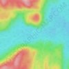
Lac Roger topographic map

Click on the map to display elevation.

About this map

Name: Lac Roger topographic map, elevation, terrain.

Location: Lac Roger, Lac-Walker, Sept-Rivières, Côte-Nord, Québec, Canada (49.99062 -67.34493 50.00194 -67.33578)

Average elevation: 246 m

Minimum elevation: 90 m

Maximum elevation: 346 m

Other topographic maps

Click on a map to view its topography, its elevation and its terrain.
Lac Veillette

Canada > Québec > Sept-Rivières > Lac-Walker

Average elevation: 316 m

Lac Perle

Canada > Québec > Sept-Rivières > Lac-Walker

Average elevation: 312 m

Lac Francis

Canada > Québec > Sept-Rivières > Lac-Walker

Average elevation: 661 m

Lac Louisa

Canada > Québec > Sept-Rivières > Lac-Walker

Average elevation: 201 m

Lac Brunelle

Canada > Québec > Sept-Rivières > Lac-Walker

Average elevation: 150 m

Lac Contact

Canada > Québec > Sept-Rivières > Lac-Walker

Average elevation: 209 m

Lac Édouard

Canada > Québec > Sept-Rivières > Lac-Walker

Average elevation: 230 m

Gear up for your next adventure:

🧴Outdoor Sunscreen - High SPF protection for high-altitude UV exposure
🥽Outdoor Goggles - Protective eyewear for outdoor activities
⛺Backpacking Tent - Lightweight tent for long-distance hiking trips
🛌Down Sleeping Bag - Superior warmth-to-weight ratio for cold nights
🔋Solar Power Bank - Keep your GPS and devices charged during long outdoor trips

As an Amazon Associate, this site earns from qualifying purchases at no extra cost to you.