Geolocate

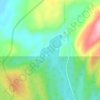
Lac Édouard topographic map

Click on the map to display elevation.

About this map

Name: Lac Édouard topographic map, elevation, terrain.

Location: Lac Édouard, Lac-Walker, Sept-Rivières, Côte-Nord, Québec, Canada (50.08693 -67.32115 50.10520 -67.30897)

Average elevation: 230 m

Minimum elevation: 116 m

Maximum elevation: 414 m

Other topographic maps

Click on a map to view its topography, its elevation and its terrain.

Lac Roger

Canada > Québec > Sept-Rivières > Lac-Walker

Average elevation: 246 m

Lac-Walker

Canada > Québec > Sept-Rivières > Lac-Walker

Average elevation: 434 m

Lac Serpent

Canada > Québec > Sept-Rivières > Lac-Walker

Average elevation: 476 m

Lac Pentecôte

Canada > Québec > Sept-Rivières > Lac-Walker

Average elevation: 233 m

Lac Walker

Canada > Québec > Sept-Rivières > Lac-Walker

Average elevation: 377 m

Lac Arthur

Canada > Québec > Sept-Rivières > Lac-Walker

Average elevation: 514 m

Gear up for your next adventure:

🛰️Satellite Messenger - Emergency communication for areas with no cell service
🥾Waterproof Hiking Boots - Essential footwear for rugged terrain and wet Canadian trails
🥾Trekking Boots - Durable boots for long-distance trekking
🚲MTB Frame Bag - Carry tools and maps directly on your bicycle frame
💡LED Camping Lantern - Illuminate your campsite with long-lasting lanterns

As an Amazon Associate, this site earns from qualifying purchases at no extra cost to you.