Geolocate

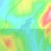
Lac Veillette topographic map

Click on the map to display elevation.

About this map

Name: Lac Veillette topographic map, elevation, terrain.

Location: Lac Veillette, Lac-Walker, Sept-Rivières, Côte-Nord, Québec, Canada (50.42775 -67.16636 50.43896 -67.15827)

Average elevation: 316 m

Minimum elevation: 111 m

Maximum elevation: 520 m

Other topographic maps

Click on a map to view its topography, its elevation and its terrain.

Lac Roger

Canada > Québec > Sept-Rivières > Lac-Walker

Average elevation: 246 m

Lac-Walker

Canada > Québec > Sept-Rivières > Lac-Walker

Average elevation: 434 m

Lac Serpent

Canada > Québec > Sept-Rivières > Lac-Walker

Average elevation: 476 m

Lac Pentecôte

Canada > Québec > Sept-Rivières > Lac-Walker

Average elevation: 233 m

Lac Walker

Canada > Québec > Sept-Rivières > Lac-Walker

Average elevation: 377 m

Lac Arthur

Canada > Québec > Sept-Rivières > Lac-Walker

Average elevation: 514 m

Gear up for your next adventure:

🔦LED Headtorch - Bright and durable light for night activities
🧢Outdoor Cap - Protective cap for sun and rain during hikes
⛺Camping Essentials - All-in-one gear for a comfortable camping trip
🪑Ultralight Camping Stool - Compact seating for rest stops during long hikes
💧Collapsible Water Bottle - Space-saving water bottle for outdoor activities

As an Amazon Associate, this site earns from qualifying purchases at no extra cost to you.