Geolocate

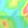
Lac Contact topographic map

Click on the map to display elevation.

About this map

Name: Lac Contact topographic map, elevation, terrain.

Location: Lac Contact, Lac-Walker, Sept-Rivières, Côte-Nord, Québec, Canada (50.35428 -66.32457 50.36807 -66.31538)

Average elevation: 209 m

Minimum elevation: 144 m

Maximum elevation: 280 m

Other topographic maps

Click on a map to view its topography, its elevation and its terrain.

Lac Roger

Canada > Québec > Sept-Rivières > Lac-Walker

Average elevation: 246 m

Lac-Walker

Canada > Québec > Sept-Rivières > Lac-Walker

Average elevation: 434 m

Lac Serpent

Canada > Québec > Sept-Rivières > Lac-Walker

Average elevation: 476 m

Lac Pentecôte

Canada > Québec > Sept-Rivières > Lac-Walker

Average elevation: 233 m

Lac Walker

Canada > Québec > Sept-Rivières > Lac-Walker

Average elevation: 377 m

Lac Arthur

Canada > Québec > Sept-Rivières > Lac-Walker

Average elevation: 514 m

Gear up for your next adventure:

🧰Emergency Multi-Tool - Compact multi-tool for outdoor survival
🧢Sun Hat - Wide-brim hat for sun protection
🦶Hiking Shoe Insoles - Added support for high arches and long days on feet
🥾Lightweight Hiking Boots - Boots for comfort and mobility on long hikes
🔦UV Flashlight - Detect minerals or specific insects in the dark

As an Amazon Associate, this site earns from qualifying purchases at no extra cost to you.