Geolocate

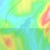
Lac Perle topographic map

Click on the map to display elevation.

About this map

Name: Lac Perle topographic map, elevation, terrain.

Location: Lac Perle, Lac-Walker, Sept-Rivières, Côte-Nord, Québec, Canada (49.77337 -67.48983 49.77716 -67.48147)

Average elevation: 312 m

Minimum elevation: 239 m

Maximum elevation: 450 m

Other topographic maps

Click on a map to view its topography, its elevation and its terrain.

Lac Roger

Canada > Québec > Sept-Rivières > Lac-Walker

Average elevation: 246 m

Lac-Walker

Canada > Québec > Sept-Rivières > Lac-Walker

Average elevation: 434 m

Lac Serpent

Canada > Québec > Sept-Rivières > Lac-Walker

Average elevation: 476 m

Lac Pentecôte

Canada > Québec > Sept-Rivières > Lac-Walker

Average elevation: 233 m

Lac Walker

Canada > Québec > Sept-Rivières > Lac-Walker

Average elevation: 377 m

Lac Arthur

Canada > Québec > Sept-Rivières > Lac-Walker

Average elevation: 514 m

Gear up for your next adventure:

🧭GPS Outdoor Watch - Smart watch for navigation and fitness tracking in nature
🧥Thermal Layer - Insulating layer for cold outdoor conditions
🧶550 Survival Paracord - Versatile utility cord for emergency repairs and rigging
🧢Outdoor Visor - Breathable visor for sunny hikes
🥾Lightweight Hiking Shoes - Comfortable shoes for day hikes

As an Amazon Associate, this site earns from qualifying purchases at no extra cost to you.