
Mankachar topographic map
Interactive map
Click on the map to display elevation.
About this map
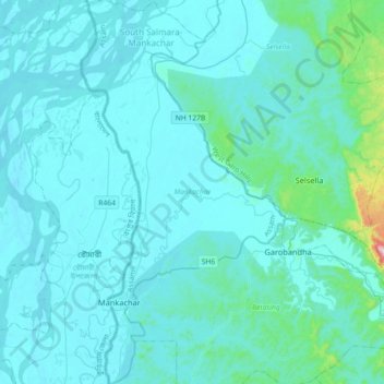
Name: Mankachar topographic map, elevation, terrain.
Location: Mankachar, South Salmara-Mankachar, Assam, Inde (25.46652 89.82716 25.79180 90.01935)
Average elevation: 53 m
Minimum elevation: 14 m
Maximum elevation: 599 m
Other topographic maps
Click on a map to view its topography, its elevation and its terrain.
Triangular Pond
Inde > Assam > Golaghat > Golaghat
Triangular Pond, Amolapatty Region — Amolapatty Old, AMOLAPATTY — OLD, Golaghat, Assam, 785621, Inde
Average elevation: 100 m