Geolocate

Eylau topographic map

Click on the map to display elevation.

About this map

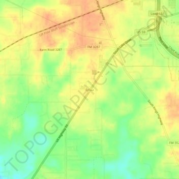
Name: Eylau topographic map, elevation, terrain.

Location: Eylau, Bowie County, Texas, United States (33.35943 -94.13642 33.39943 -94.09642)

Average elevation: 93 m

Minimum elevation: 70 m

Maximum elevation: 109 m

Other topographic maps

Click on a map to view its topography, its elevation and its terrain.

Texarkana

United States > Texas > Bowie County

Average elevation: 99 m

Hooks

United States > Texas > Bowie County

Average elevation: 112 m

New Boston

United States > Texas > Bowie County

Average elevation: 108 m

Texarkana

United States > Texas > Bowie County

Average elevation: 99 m

Texarkana

United States > Texas > Bowie County

Average elevation: 99 m

De Kalb

United States > Texas > Bowie County

Average elevation: 118 m

Red Lick

United States > Texas > Bowie County

Average elevation: 104 m

Texarkana

United States > Texas > Bowie County

Average elevation: 99 m

Hooks

United States > Texas > Bowie County

Average elevation: 112 m

Maud

United States > Texas > Bowie County

Average elevation: 87 m

Nash

United States > Texas > Bowie County

Average elevation: 104 m

Redwater

United States > Texas > Bowie County

Average elevation: 87 m

Gear up for your next adventure:

🧢Hiking Sun Hat - Wide-brimmed protection for exposed mountain ridges
🥾Hiking Shoes - Durable and comfortable shoes for trail hiking
🔋Solar Power Bank - Keep your GPS and devices charged during long outdoor trips
🧢Outdoor Visor - Breathable visor for sunny hikes
🧢Hiking Hat - Sun-protective and breathable hats for long treks

As an Amazon Associate, this site earns from qualifying purchases at no extra cost to you.