Geolocate

Maud topographic map

Click on the map to display elevation.

About this map

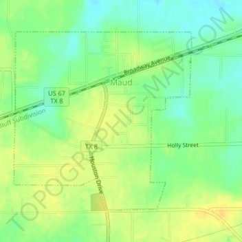
Name: Maud topographic map, elevation, terrain.

Location: Maud, Bowie County, Texas, United States (33.31852 -94.35707 33.33853 -94.33328)

Average elevation: 87 m

Minimum elevation: 74 m

Maximum elevation: 99 m

Other topographic maps

Click on a map to view its topography, its elevation and its terrain.

Old Salem

United States > Texas > Bowie County

Average elevation: 110 m

Eylau

United States > Texas > Bowie County

Average elevation: 93 m

Eylau

United States > Texas > Bowie County

Average elevation: 93 m

Gear up for your next adventure:

🦟Insect Repellent - Keep mosquitoes and black flies away in wooded areas
🪑Ultralight Camping Stool - Compact seating for rest stops during long hikes
🥤Collapsible Travel Cup - Saves space and weight in your mess kit
🐕Hiking Dog Pack - Let your canine companion carry their own water and food
🔋Emergency Crank Radio - Weather alerts and power without needing batteries

As an Amazon Associate, this site earns from qualifying purchases at no extra cost to you.