
Skjærhalden topographic map
Interactive map
Click on the map to display elevation.
About this map
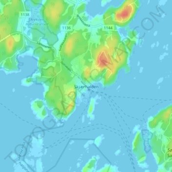
Name: Skjærhalden topographic map, elevation, terrain.
Location: Skjærhalden, Hvaler, Viken, 1680, Norvège (59.00527 11.01685 59.04527 11.05685)
Average elevation: 7 m
Minimum elevation: -2 m
Maximum elevation: 44 m
Other topographic maps
Click on a map to view its topography, its elevation and its terrain.