
Gjerdrum topographic map
Interactive map
Click on the map to display elevation.
About this map
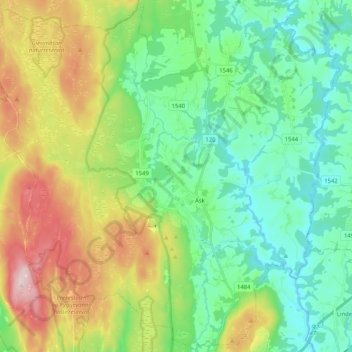
Name: Gjerdrum topographic map, elevation, terrain.
Location: Gjerdrum, Viken, 2022, Norvège (60.02853 10.91114 60.12900 11.11614)
Average elevation: 213 m
Minimum elevation: 104 m
Maximum elevation: 447 m
Other topographic maps
Click on a map to view its topography, its elevation and its terrain.