
Maimana topographic map
Interactive map
Click on the map to display elevation.
About this map
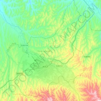
Name: Maimana topographic map, elevation, terrain.
Location: Maimana, Faryab, Afghanistan (35.86355 64.70307 36.02994 64.86199)
Average elevation: 890 m
Minimum elevation: 680 m
Maximum elevation: 1,334 m
Other topographic maps
Click on a map to view its topography, its elevation and its terrain.
ولسوالی خواجه سبزپوش ولی
ولسوالی خواجه سبزپوش ولی, Faryab, Afghanistan
Average elevation: 900 m
التی بولاق تزکن
Afghanistan > Faryab > ولسوالی قرمقل > التی بولاق تزکن
التی بولاق تزکن, ولسوالی قرمقل, Faryab, Afghanistan
Average elevation: 323 m