
ولسوالی خواجه سبزپوش ولی topographic map
Interactive map
Click on the map to display elevation.
About this map
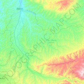
Name: ولسوالی خواجه سبزپوش ولی topographic map, elevation, terrain.
Location: ولسوالی خواجه سبزپوش ولی, Faryab, Afghanistan (35.93727 64.80217 36.17344 65.18934)
Average elevation: 900 m
Minimum elevation: 545 m
Maximum elevation: 1,827 m
Other topographic maps
Click on a map to view its topography, its elevation and its terrain.
التی بولاق تزکن
Afghanistan > Faryab > ولسوالی قرمقل > التی بولاق تزکن
التی بولاق تزکن, ولسوالی قرمقل, Faryab, Afghanistan
Average elevation: 323 m