
Maimana topographic map
Interactive map
Click on the map to display elevation.
About this map
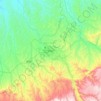
Name: Maimana topographic map, elevation, terrain.
Location: Maimana, Faryab, Afghanistan (35.76039 64.62225 36.08039 64.94225)
Average elevation: 989 m
Minimum elevation: 601 m
Maximum elevation: 1,872 m
Maimana liegt am Nordrand der Bergkette Band-i Turkistan auf einer Höhe von 877 m auf den Flussterrassen des Flusses Qeysar. Die Bergländer um Maimana bieten fruchtbaren Boden für die heimische Landwirtschaft.