Geolocate

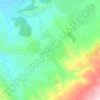
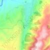
Srar topographic map

Click on the map to display elevation.

About this map

Name: Srar topographic map, elevation, terrain.

Location: Srar, Akkar District, Akkar Governorate, Lebanon (34.61076 36.12017 34.62320 36.14120)

Average elevation: 139 m

Minimum elevation: 30 m

Maximum elevation: 263 m

Other topographic maps

Click on a map to view its topography, its elevation and its terrain.

Karm Zabdin

Lebanon > Akkar Governorate

Average elevation: 530 m

Aayoun

Lebanon > Akkar Governorate

Average elevation: 572 m

Beit Mellat

Lebanon > Akkar Governorate

Average elevation: 525 m

Halba

Lebanon > Akkar Governorate

Average elevation: 195 m

Rahbeh

Lebanon > Akkar Governorate

Average elevation: 603 m

Al Qoubaiyat

Lebanon > Akkar Governorate

Average elevation: 689 m

Fnaydeq

Lebanon > Akkar Governorate

Average elevation: 1,190 m

Sammouniyeh

Lebanon > Akkar Governorate

Average elevation: 33 m

Beit Ayoub

Lebanon > Akkar Governorate

Average elevation: 1,003 m

Al Abbudiyya

Lebanon > Akkar Governorate

Average elevation: 53 m

Khreibet Ej Jindi

Lebanon > Akkar Governorate

Average elevation: 149 m

Shadra

Lebanon > Akkar Governorate

The population is Greek Orthodox and other Christian. The village is situated at a distance of 146km from Beirut at an altitude of 450 m above sea level. It has an area of 651 hectares, surrounded by Akroum from the east, the west Owainat, from the north Machta Hassan and Andaket from the south . Can be…

Average elevation: 516 m

Andakit

Lebanon > Akkar Governorate

Average elevation: 629 m

Koucha

Lebanon > Akkar Governorate

Average elevation: 170 m

Qantara

Lebanon > Akkar Governorate > Qantara

Average elevation: 280 m

El Aarida

Lebanon > Akkar Governorate

Average elevation: 2 m

Wadi Khalid

Lebanon > Akkar Governorate

Average elevation: 498 m

Qoubbet Chamra

Lebanon > Akkar Governorate

Average elevation: 25 m

Akrum

Lebanon > Akkar Governorate

Average elevation: 900 m

Houeich

Lebanon > Akkar Governorate

Average elevation: 518 m

Furaydis

Lebanon > Akkar Governorate

Average elevation: 335 m

Gear up for your next adventure:

🏃Hydration Running Vest - Carry water and maps close to your body for speed
🧦Merino Wool Socks - Moisture-wicking comfort for long-distance hiking
🥾Hiking Gaiters - Protect legs and shoes from mud, snow, and debris
🌡️Emergency Mylar Blankets - Compact thermal protection for unexpected nights outdoors
🥾Trail Hiking Boots - Supportive boots for rough trails

As an Amazon Associate, this site earns from qualifying purchases at no extra cost to you.