Geolocate

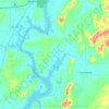
Stemley topographic map

Click on the map to display elevation.

About this map

Name: Stemley topographic map, elevation, terrain.

Location: Stemley, Talladega County, Alabama, 35728, United States (33.49844 -86.24248 33.53844 -86.20248)

Average elevation: 157 m

Minimum elevation: 139 m

Maximum elevation: 215 m

Other topographic maps

Click on a map to view its topography, its elevation and its terrain.

Sylacauga

United States > Alabama > Talladega County

Average elevation: 194 m

Childersburg

United States > Alabama > Talladega County

Average elevation: 146 m

Lincoln

United States > Alabama > Talladega County

Average elevation: 169 m

Talladega

United States > Alabama > Talladega County

Average elevation: 191 m

Sylacauga

United States > Alabama > Talladega County

Average elevation: 194 m

Childersburg

United States > Alabama > Talladega County

Average elevation: 146 m

Mignon

United States > Alabama > Talladega County > Mignon

Average elevation: 173 m

Gear up for your next adventure:

🔪Outdoor Multitool - Versatile tool for repairs and food prep in the wild
🧤Rechargeable Heated Gloves - Extreme warmth for Canadian winter expeditions
🎒Fully Waterproof Backpack - Total protection for photography gear and electronics
🧊Insulated Water Bottle - Keeps drinks cold in summer and prevents freezing in winter
🧦Hiking Socks - Moisture-wicking and comfortable socks for long hikes

As an Amazon Associate, this site earns from qualifying purchases at no extra cost to you.