

Melilla topographic map
Click on the map to display elevation.
Melilla
The relief of Melilla is characterized by its variety, including a rocky peninsula, an elevated plateau, and a volcanic massif. The Melilla Peninsula, which extends into the Mediterranean Sea, is dominated by elevated terrain. To the southeast is the coastal lagoon of Mar Chica, and to the south lies the volcanic massif of Gurugú. The city's maximum altitude exceeds 200 meters above sea level. Melilla is built on a hill that gently slopes down towards the sea to the east, while the western area features more rugged terrain. The eastern coast has rocky cliffs with panoramic views of the sea. This diverse relief has influenced the urban layout, with the old town adapted to the irregularities of the land, while the more modern neighborhoods extend into the flatter areas.
About this map
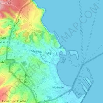
Name: Melilla topographic map, elevation, terrain.
Location: Melilla, 52001, Spain (35.26563 -2.97020 35.32015 -2.92310)
Average elevation: 48 m
Minimum elevation: -2 m
Maximum elevation: 210 m