Geolocate

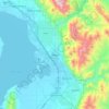
Utah County topographic map

Click on the map to display elevation.

Utah County

Utah Valley lies at the center of the county, lined by the mountains of the Wasatch Range on the east. Utah Lake occupies a large part of the valley. The elevation ranges from 4,487 feet (1,368 m) above sea level at the lake to 11,928 feet (3,636 m) at the peak of Mount Nebo.

Wikipedia (CC-BY-SA 3.0)

About this map

Name: Utah County topographic map, elevation, terrain.

Location: Utah County, Utah, United States (39.77625 -112.21419 40.57791 -110.85765)

Average elevation: 2,016 m

Minimum elevation: 1,280 m

Maximum elevation: 3,582 m

Other topographic maps

Click on a map to view its topography, its elevation and its terrain.
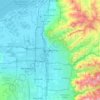
Salt Lake City

United States > Utah > Salt Lake County > Salt Lake City

Salt Lake City has an area of 110.4 square miles (286 km2) and an average elevation of 4,327 feet (1,319 m) above sea level. The lowest point within the boundaries of the city is 4,210 feet (1,280 m) near the Jordan River and the Great Salt Lake, and the highest is Grandview Peak, at 9,410 feet (2,868 m).

Average elevation: 1,625 m
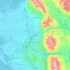
Ogden

United States > Utah > Weber County > Ogden

According to the United States Census Bureau, the city has an area of 26.6 square miles (69.0 km2), all land. Elevations in the city range from about 4,300 to 5,000 feet (1,300 to 1,500 m) above sea level.

Average elevation: 1,557 m
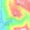
Kyhv Peak

United States > Utah > Utah County

Average elevation: 1,995 m

Paria

United States > Utah > Kane County

Average elevation: 1,538 m

Provo

United States > Utah > Utah County > Provo

Average elevation: 1,733 m

Wildwood

United States > Utah > Utah County

Average elevation: 1,879 m

Gates Lake

United States > Utah > Duchesne County

Average elevation: 3,121 m

Corrine Ballpark

United States > Utah > Box Elder County > Corinne

Average elevation: 1,288 m

Millcreek

United States > Utah > Salt Lake County > Millcreek

Average elevation: 1,715 m

Coal Creek

United States > Utah > Iron County > Cedar City

Average elevation: 1,922 m

Dunford

United States > Utah > Salt Lake County > Salt Lake City

Average elevation: 1,297 m

Midlake

United States > Utah > Box Elder County

Average elevation: 1,282 m

Pinto Lake

United States > Utah > Duchesne County

Average elevation: 3,106 m

Alta Vista

United States > Utah > Weber County > Ogden

Average elevation: 1,505 m

Wallace Heights

United States > Utah > Salt Lake County > Sandy

Average elevation: 1,346 m

Jeremy Ranch

United States > Utah > Summit County

Average elevation: 2,048 m

Stettler

United States > Utah > Weber County > Ogden

Average elevation: 1,474 m

Sprucewood

United States > Utah > Salt Lake County > Sandy

Average elevation: 1,418 m

Brighton

United States > Utah > Salt Lake County

Brighton has a high-altitude cold continental climate (Köppen Dsb/Dsc), with dry summers and very snowy winters.

Average elevation: 2,852 m

Gear up for your next adventure:

🚲Heavy Duty Bike Lock - Secure your bike at the trailhead or during stops
🏕️Camping Hammock - Integrated protection for sleeping between trees
🥾Mountain Hiking Shoes - Shoes with superior grip for mountainous terrain
🥾Durable Hiking Shoes - Long-lasting shoes for frequent hiking
💡LED Camping Lantern - Illuminate your campsite with long-lasting lanterns

As an Amazon Associate, this site earns from qualifying purchases at no extra cost to you.