
Thank you for supporting this site ❤️
Make a donation
Make a donation
Gear up for your next adventure:
As an Amazon Associate, this site earns from qualifying purchases at no extra cost to you.
Millcreek topographic map
Click on the map to display elevation.
Thank you for supporting this site ❤️
Make a donation
Make a donation
Gear up for your next adventure:
As an Amazon Associate, this site earns from qualifying purchases at no extra cost to you.
About this map
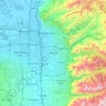
Name: Millcreek topographic map, elevation, terrain.
Location: Millcreek, Salt Lake County, Utah, 84106, United States (40.53929 -112.01558 40.85929 -111.69558)
Average elevation: 1,715 m
Minimum elevation: 1,282 m
Maximum elevation: 3,466 m
Thank you for supporting this site ❤️
Make a donation
Make a donation
Gear up for your next adventure:
As an Amazon Associate, this site earns from qualifying purchases at no extra cost to you.