Geolocate

Provo topographic map

Click on the map to display elevation.

About this map

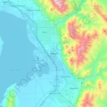
Name: Provo topographic map, elevation, terrain.

Location: Provo, Utah County, Utah, 84606, United States (40.07373 -111.81871 40.39373 -111.49871)

Average elevation: 1,733 m

Minimum elevation: 1,364 m

Maximum elevation: 3,556 m

Gear up for your next adventure:

💡LED Headlamp - Hands-free illumination for night hiking and camping
🥾Trail Hiking Shoes - Durable shoes designed for rugged trails
Camping Coffee Maker - Brew fresh coffee anywhere on the topographic map
🔋Lithium AA Batteries - Long-lasting power that performs in extreme cold
🧥Waterproof Jacket - Lightweight rain jackets for hiking and outdoor activities

As an Amazon Associate, this site earns from qualifying purchases at no extra cost to you.