Geolocate

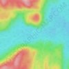
Rivière aux Rochers topographic map

Click on the map to display elevation.

About this map

Name: Rivière aux Rochers topographic map, elevation, terrain.

Location: Rivière aux Rochers, Lac-Walker, Sept-Rivières, Côte-Nord, Québec, Canada (50.02226 -67.13721 50.14148 -66.86877)

Average elevation: 154 m

Minimum elevation: -1 m

Maximum elevation: 322 m

Other topographic maps

Click on a map to view its topography, its elevation and its terrain.
Lac Veillette

Canada > Québec > Sept-Rivières > Lac-Walker

Average elevation: 316 m

Lac Perle

Canada > Québec > Sept-Rivières > Lac-Walker

Average elevation: 312 m

Lac Francis

Canada > Québec > Sept-Rivières > Lac-Walker

Average elevation: 661 m

Lac Louisa

Canada > Québec > Sept-Rivières > Lac-Walker

Average elevation: 201 m

Lac Brunelle

Canada > Québec > Sept-Rivières > Lac-Walker

Average elevation: 150 m

Lac Contact

Canada > Québec > Sept-Rivières > Lac-Walker

Average elevation: 209 m

Lac Édouard

Canada > Québec > Sept-Rivières > Lac-Walker

Average elevation: 230 m

Gear up for your next adventure:

🧊Portable Cooler - Keep food and drinks cold during outdoor adventures
🧴Waterproofing Spray - Restore the DWR coating on jackets and tents
🪑Ultralight Camping Stool - Compact seating for rest stops during long hikes
🛶Waterproof Dry Bags - Keep electronics and clothes dry during river crossings
⛺Camping Essentials - All-in-one gear for a comfortable camping trip

As an Amazon Associate, this site earns from qualifying purchases at no extra cost to you.