Czechia topographic maps
Click on a map to view its topography, its elevation and its terrain.
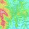
Kvilda
Czechia > Southwest > South Bohemian Region
Kvilda (German: Außergefild) is a municipality and village in Prachatice District in the South Bohemian Region of the Czech Republic. It has about 100 inhabitants. At an altitude of 1,065 metres (3,494 ft), it is the highest municipality in the Czech Republic. It is also one of the coldest places in the…
Average elevation: 1,095 m
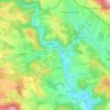
Vrchlabí
Czechia > Northeast > Hradec Králové Region
Vrchlabí is located about 21 kilometres (13 mi) northwest of Trutnov and 48 km (30 mi) north of Hradec Králové. About half of the municipal territory lies in the Giant Mountains, and its northern part lies in the Krkonoše National Park. The seat of the administration of the national park is located in…
Average elevation: 620 m

Jihlava
Jihlava is located in the heart of the Bohemian-Moravian Highlands. The northern part of the territory lies in the Upper Sázava Hills and the southern part lies in the Křižanov Highlands. The highest point is the hill Popický vrch with an elevation of 682 metres (2,238 ft), located on the southern…
Average elevation: 553 m
Strakonice
Czechia > Southwest > South Bohemian Region
Strakonice is located about 51 kilometres (32 mi) northwest of České Budějovice. It lies mostly in the northern tip of the České Budějovice Basin, but the municipal territory also extends to the Blatná Uplands on the north and to the Bohemian Forest Foothills on the south. The highest point is the hill…
Average elevation: 448 m
Tábor
Tábor is located in the Tábor Uplands. The highest point is the Hýlačka hill with an altitude of 525 m (1,722 ft) and the lowest is the surface of the river Lužnice. The historic old town is situated on a hill above the river, which was used for the protection of the town.
Average elevation: 464 m
Vsetín
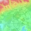
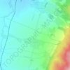
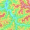
Vsetín is located about 25 kilometres (16 mi) northeast of Zlín and 54 km (34 mi) west of Žilina in Slovakia. It lies in a hilly landscape of the Hostýn-Vsetín Mountains. The highest point of the municipal territory is the Cáb mountain with an elevation of 841 m (2,759 ft), which is located on the…
Average elevation: 481 m


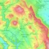

Brdy
Czechia > Central Bohemia > Obecnice
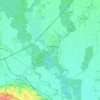
Brdy is a range of hills in the Czech Republic, forming a long massif stretching for c. 60 km southwest from Prague. The northern section of the Brdy is called "Hřebeny" and features one narrow ridge (highest elevation Písek - 690 m). The main Brdy range starts south of the Litavka river gorge and consists…
Average elevation: 782 m
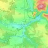
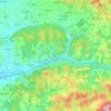
Zlín
Czechia > Central Moravia > Zlínský kraj
Zlín is entirely located in the Vizovice Highlands. The highest point of the municipal territory is the top of the hill Tlustá hora with an elevation of 458 metres (1,503 ft).
Average elevation: 312 m