
Thank you for supporting this site ❤️
Make a donation
Make a donation
Gear up for your next adventure:
As an Amazon Associate, this site earns from qualifying purchases at no extra cost to you.
Kočov topographic map
Click on the map to display elevation.
Thank you for supporting this site ❤️
Make a donation
Make a donation
Gear up for your next adventure:
As an Amazon Associate, this site earns from qualifying purchases at no extra cost to you.
About this map
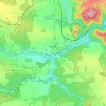
Name: Kočov topographic map, elevation, terrain.
Location: Kočov, okres Tachov, Plzeňský kraj, Southwest, Czechia (49.78904 12.68472 49.82220 12.76465)
Average elevation: 487 m
Minimum elevation: 431 m
Maximum elevation: 591 m
Thank you for supporting this site ❤️
Make a donation
Make a donation
Gear up for your next adventure:
As an Amazon Associate, this site earns from qualifying purchases at no extra cost to you.