Geolocate

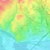
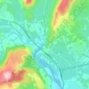
Jacou topographic map

Click on the map to display elevation.

About this map

Name: Jacou topographic map, elevation, terrain.

Location: Jacou, Montpellier, Hérault, Occitania, Metropolitan France, 34830, France (43.65414 3.89905 43.67543 3.92846)

Average elevation: 64 m

Minimum elevation: 29 m

Maximum elevation: 110 m

Other topographic maps

Click on a map to view its topography, its elevation and its terrain.
Rabieux

France > Occitania > Hérault > Ceyras

Average elevation: 123 m

Portiragnes Plage

France > Occitania > Hérault > Portiragnes

Average elevation: 2 m

Saint-Jean d'Aureilhan

France > Occitania > Hérault > Béziers

Average elevation: 39 m

Place de la Mairie

France > Occitania > Hérault > Marseillan

Average elevation: 7 m

Gear up for your next adventure:

🧴Outdoor Sunscreen - High SPF protection for high-altitude UV exposure
🎒Fully Waterproof Backpack - Total protection for photography gear and electronics
🦟Insect Repellent - Keep mosquitoes and black flies away in wooded areas
🧥Softshell Jacket - Windproof and breathable jacket for hiking
🥘Camping Cookware Set - Compact nesting pots and pans for trail cooking

As an Amazon Associate, this site earns from qualifying purchases at no extra cost to you.