Geolocate

Morang topographic maps

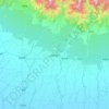
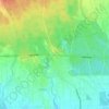
Click on a map to view its topography, its elevation and its terrain.

Mangadh

Nepal > Koshi Province > Morang

Average elevation: 78 m

Bakra

Nepal > Koshi Province > Morang

Average elevation: 228 m

Biratnagar

Nepal > Koshi Province > Morang

Average elevation: 70 m

Letang

Nepal > Koshi Province > Morang

Average elevation: 616 m

Sundarharaicha

Nepal > Koshi Province > Morang

Average elevation: 126 m

Sundarharaicha

Nepal > Koshi Province > Morang

Average elevation: 228 m

Betana Wetlands

Nepal > Koshi Province > Morang

Average elevation: 136 m

Ratuwamai-10

Nepal > Koshi Province > Morang

Average elevation: 94 m

Pathari

Nepal > Koshi Province > Morang

Average elevation: 139 m

Patahrishanishchare

Nepal > Koshi Province > Morang

Average elevation: 110 m

Gear up for your next adventure:

🛌Insulated Sleeping Pad - Critical thermal barrier between you and the cold ground
🧥Ultralight Puffy Jacket - Maximum warmth that packs down to the size of an orange
🧥Softshell Hiking Jacket - The perfect balance of wind protection and breathability
🧰Multitool Knife - Compact and versatile tool for outdoor use
🔋Emergency Crank Radio - Weather alerts and power without needing batteries

As an Amazon Associate, this site earns from qualifying purchases at no extra cost to you.