Geolocate

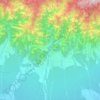
Mangadh topographic map

Click on the map to display elevation.

About this map

Name: Mangadh topographic map, elevation, terrain.

Location: Mangadh, Budhiganga, Morang, Koshi Province, Nepal (26.48428 87.26814 26.52428 87.30814)

Average elevation: 78 m

Minimum elevation: 73 m

Maximum elevation: 85 m

Other topographic maps

Click on a map to view its topography, its elevation and its terrain.
Biratnagar

Nepal > Koshi Province > Morang

Average elevation: 70 m

Letang

Nepal > Koshi Province > Morang

Average elevation: 616 m

Sundarharaicha

Nepal > Koshi Province > Morang

Average elevation: 126 m

Ratuwamai-10

Nepal > Koshi Province > Morang

Average elevation: 94 m

Betana Wetlands

Nepal > Koshi Province > Morang

Average elevation: 136 m

Patahrishanishchare

Nepal > Koshi Province > Morang

Average elevation: 110 m

Gear up for your next adventure:

🧴Sunscreen SPF - Broad-spectrum sunscreen for outdoor activities
🥾Trekking Boots - Durable boots for long-distance trekking
🦶Hiking Shoe Insoles - Added support for high arches and long days on feet
🥾Hiking Leggings - Comfortable leggings for outdoor activities
💡Portable Camping Lamp - Rechargeable lamp for campsite lighting

As an Amazon Associate, this site earns from qualifying purchases at no extra cost to you.