Geolocate

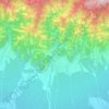
Bakra topographic map

Click on the map to display elevation.

About this map

Name: Bakra topographic map, elevation, terrain.

Location: Bakra, Miklajung, Morang, Koshi Province, Nepal (26.73354 87.61648 26.77354 87.65648)

Average elevation: 228 m

Minimum elevation: 156 m

Maximum elevation: 411 m

Other topographic maps

Click on a map to view its topography, its elevation and its terrain.
Biratnagar

Nepal > Koshi Province > Morang

Average elevation: 70 m

Letang

Nepal > Koshi Province > Morang

Average elevation: 616 m

Sundarharaicha

Nepal > Koshi Province > Morang

Average elevation: 126 m

Ratuwamai-10

Nepal > Koshi Province > Morang

Average elevation: 94 m

Betana Wetlands

Nepal > Koshi Province > Morang

Average elevation: 136 m

Patahrishanishchare

Nepal > Koshi Province > Morang

Average elevation: 110 m

Gear up for your next adventure:

💧Collapsible Water Bottle - Space-saving water bottle for outdoor activities
🛶Kayak Accessories - Essential gear for safe and fun kayaking adventures
🧴Bear Spray Holster - Quick-access carry for essential Canadian wilderness safety
🥾Trail Running Boots - Durable shoes designed for trail running
🚲Handlebar Phone Mount - View topographic-map.com live while cycling

As an Amazon Associate, this site earns from qualifying purchases at no extra cost to you.