Geolocate

Armagh topographic maps

Click on a map to view its topography, its elevation and its terrain.

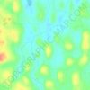
Tullysaran

United Kingdom > Northern Ireland > Armagh

Average elevation: 36 m

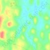
Whitecross

United Kingdom > Northern Ireland > Armagh

Average elevation: 127 m

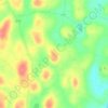
Drumay

United Kingdom > Northern Ireland > Armagh

Average elevation: 58 m

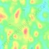
Derryfubble

United Kingdom > Northern Ireland > Armagh

Average elevation: 63 m

Gear up for your next adventure:

🕶️Polarized Sunglasses - Reduces glare from snow and water at high elevations
💧Hydration Pack - Hands-free hydration system for long hikes
👖Convertible Hiking Pants - Zip-off legs to adapt to changing weather conditions
🏕️Camping Hammock - Integrated protection for sleeping between trees
🧥Packable Rain Jacket - Breathable waterproof layer for unpredictable weather

As an Amazon Associate, this site earns from qualifying purchases at no extra cost to you.