Geolocate

Italy topographic maps

Click on a map to view its topography, its elevation and its terrain.
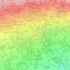
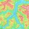
Milan

Italy > Lombardy > Milan

Average elevation: 130 m

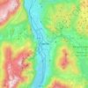
Lake Como

Italy > Lombardy > Como

Average elevation: 885 m

Lake Vico

Italy > Lazio > Viterbo > Caprarola

Lake Vico (Italian: Lago di Vico) is a caldera lake in the northern Lazio region, central Italy. It is one of the highest major Italian lakes, with an altitude of 510 m. Administratively, it is part of the municipalities of Caprarola and Ronciglione.

Average elevation: 520 m

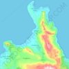
San Vito Lo Capo

Italy > Sicily > Trapani

Average elevation: 156 m

Roma Capitale

Italy > Lazio

Average elevation: 308 m

Chiusa Sclafani

Italy > Sicily > Palermo

Average elevation: 575 m

Trento

Italy > Trentino – Alto Adige/Südtirol > Provincia di Trento

The municipality of Trento stretches across a wide range of altitude levels, going from just under 200 m above sea level at the city centre, to 400 m in Povo and Cognola, to 2000 m above sea level at Monte Bondone, boroughs at higher elevation, for instance Viote, have a colder alpine climate (Dw). Urban…

Average elevation: 786 m

Manarola

Italy > Liguria > La Spezia > Manarola

Average elevation: 161 m

Salerno

Italy > Campania > Salerno

Average elevation: 161 m

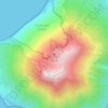
Stromboli

Italy > Sicily > Messina > Lipari

Average elevation: 372 m

Frosinone

Italy > Lazio > Frosinone

Average elevation: 198 m

Fontainemore

Italy > Aosta Valley

Average elevation: 1,578 m

Abruzzo

Italy

In Abruzzo there are two climatic zones. The coastal strip and sub-Apennine hills have a climate markedly different from that of the mountainous interior. Coastal areas have a Mediterranean climate with hot dry summers and mild winters. Inland hilly areas have a sublittoral climate with temperatures decreasing…

Average elevation: 658 m

Aosta

Italy > Aosta Valley > Aosta

Average elevation: 1,992 m

Solighetto

Italy > Veneto > Treviso > Pieve di Soligo

Average elevation: 179 m

Fornovolasco

Italy > Tuscany > Lucca

Average elevation: 894 m

Moggio Udinese

Italy > Friuli – Venezia Giulia > Udine

Average elevation: 1,038 m

Chiavenna

Italy > Lombardy > Sondrio > Chiavenna

Average elevation: 914 m

Ripi

Italy > Lazio > Frosinone

Average elevation: 184 m

Calabria

Italy

Average elevation: 156 m

Contrada Vallone Rosso

Italy > Sicily > Catania > Biancavilla

Average elevation: 931 m

Chiusi

Italy > Tuscany > Siena

Average elevation: 294 m

Meina

Italy > Piedmont > Novara

Average elevation: 302 m

Budoia

Italy > Friuli-Venezia Giulia > Pordenone

Average elevation: 545 m

Fabiano Alto

Italy > Liguria > La Spezia > La Spezia

Average elevation: 174 m

Novara

Italy > Piedmont > Novara

Average elevation: 149 m

Pisa

Italy > Tuscany > Pisa

Average elevation: 11 m

Pietrabruna

Italy > Liguria > Provincia di Imperia

Average elevation: 480 m

Chia

Italy > Sardinia > Domus De Maria

Average elevation: 54 m

Ragusa

Italy > Sicily > Ragusa

Average elevation: 330 m

Bosa

Italy > Sardinia > Aristanis/Oristano

Average elevation: 239 m

Latina

Italy > Lazio > Latina

Average elevation: 57 m

Fontechiari

Italy > Lazio > Frosinone

Average elevation: 425 m

Cordovado

Italy > Friuli – Venezia Giulia > Pordenone

Average elevation: 14 m

Xino

Italy > Lombardy > Bergamo > Fonteno

Average elevation: 512 m

Pianello Val Tidone

Italy > Emilia-Romagna > Piacenza

Average elevation: 366 m

Auronzo di Cadore

Italy > Veneto > Belluno

Average elevation: 1,642 m

Vicenza

Italy > Veneto

Average elevation: 455 m

San Giovanni Lupatoto

Italy > Veneto > Verona

Average elevation: 39 m

Libarna

Italy > Piedmont > Alessandria > Serravalle Scrivia

Average elevation: 268 m

Trapani

Italy > Sicily > Trapani

Average elevation: 56 m

Cagliari

Italy > Sardinia > Casteddu/Cagliari

Average elevation: 10 m

Paderno Dugnano

Italy > Lombardy > Milan

Average elevation: 167 m

Monza

Italy > Lombardy > Monza and Brianza

Monza is located in the high plains of Lombardy, between Brianza and Milan, at an altitude of 162 metres (531 feet) above sea level. It is 15 kilometres (9 mi) from the centre of the region's capital, although when considering the cities borders, they are separated by less than 5 km (3 miles). Monza is about…

Average elevation: 175 m

Isola di Linosa

Italy > Sicily > Agrigento > Linosa

Average elevation: 17 m

Camo

Italy > Piedmont > Cuneo > Santo Stefano Belbo

Average elevation: 337 m

Bettolle

Italy > Tuscany > Siena > Sinalunga

Average elevation: 260 m

Livorno

Italy > Tuscany > Livorno

Average elevation: 26 m

Cremona

Italy > Lombardy > Cremona

Average elevation: 43 m

Friuli-Venezia Giulia

Italy

To the west, the coast is shallow and sandy, with numerous tourist resorts and the lagoons of Grado and Marano Lagunare. To the east, the coastline rises into cliffs, where the Karst Plateau meets the Adriatic, all the way to Trieste and Muggia on the border with Slovenia. The Carso has geological features and…

Average elevation: 588 m

Lampedusa

Italy > Sicily > Agrigento > Lampedusa

Average elevation: 7 m

Battaglia di Canne

Italy > Apulia > Barletta

Average elevation: 22 m

Mazzarrà Sant'Andrea

Italy > Sicily > Messina

Average elevation: 244 m

Porto Cesareo

Italy > Apulia > Lecce

Average elevation: 31 m

Candela

Italy > Apulia > Foggia

Average elevation: 352 m

L'Aquila

Italy > Abruzzo > L'Aquila > L'Aquila

Close to the highest of the Apennine summits, L'Aquila is positioned at an elevation of 721 metres (2,365 ft) in the Valley of the Aterno-Pescara, situated between four mountain peaks above 2,000 metres (6,600 ft).

Average elevation: 1,192 m

Pescara

Italy > Abruzzo > Pescara

Average elevation: 34 m

Cortona

Italy > Tuscany > Arezzo

The prevailing character of Cortona's architecture is medieval with steep narrow streets situated on a hillside at an elevation of 600 metres (2,000 ft) that embraces a view of the whole of the Valdichiana. From the Piazza Garibaldi (still referred to by the local population by its older name, Piazza…

Average elevation: 375 m

Modena

Italy > Emilia-Romagna > Modena

Average elevation: 40 m

San Giorgio

Italy > Veneto > Verona > Bosco Chiesanuova

Average elevation: 1,514 m

Durgali/Dorgali

Italy > Sardinia > Nuoro

Average elevation: 224 m

Monte Sant'Angelo

Italy > Apulia > Foggia

Average elevation: 456 m

Sulmona

Italy > Abruzzo > L'Aquila

Average elevation: 707 m

Martinsicuro

Italy > Abruzzo > Teramo

Average elevation: 40 m

Lesignano de' Bagni

Italy > Emilia-Romagna > Parma

Average elevation: 328 m

Lombardy

Italy

Lombardy has a wide array of climates due to variance in elevation, proximity to inland water basins, and large metropolitan areas. The climate is mainly humid subtropical (Köppen Cfa), especially in the plains, though with significant variations to the Köppen model, especially in the normally long, damp,…

Average elevation: 797 m

Livigno

Italy > Lombardy > Sondrio

Only three roads lead to the town. Two link to Switzerland, one through the Forcola di Livigno, elevation 2,315 m (7,595 ft) and open in summer only, and the second through the Munt la Schera Tunnel. The third road connects to other parts of Italy through the Foscagno Pass, elevation 2,291 m (7,516 ft).

Average elevation: 2,388 m
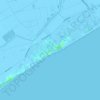
Duna Verde

Italy > Veneto > Venezia > Caorle

Average elevation: -1 m

Strepeis

Italy > Piedmont > Cuneo > Bagni di Vinadio

Average elevation: 1,758 m

Tonda

Italy > Tuscany > Florence > Sughera

Average elevation: 177 m

Pontorme

Italy > Tuscany > Florence > Empoli

Average elevation: 31 m

Serbelloni

Italy > Lombardy > Milan > Pregnana Milanese

Average elevation: 153 m

Roccamena

Italy > Sicily > Palermo

Average elevation: 298 m

Erice

Italy > Sicily > Trapani

Average elevation: 85 m

Lecce

Italy > Apulia

Average elevation: 29 m

Alba Adriatica

Italy > Abruzzo > Teramo

Average elevation: 37 m

Levice

Italy > Piedmont > Cuneo

Average elevation: 487 m

La Spezia

Italy > Liguria

Average elevation: 354 m

Ancona

Italy > Marche

Average elevation: 233 m

Aviano

Italy > Friuli – Venezia Giulia > Pordenone

Although the village is located at the foot of the Dolomites, the municipality extends to an altitude of 2,251 metres (7,385 feet) above sea level (Cimon del Cavallo peak).

Average elevation: 475 m

San Marino

Italy > Veneto > Vicenza > San Marino

Average elevation: 683 m

Caberra

Italy > Emilia-Romagna > Parma > Bardi

Average elevation: 717 m

Sant'Antonio

Italy > Crotone > Isola di Capo Rizzuto

Average elevation: 22 m

Ponte Rio

Italy > Umbria > Perugia > Perugia

Average elevation: 367 m

Foggia

Italy > Apulia > Foggia

Average elevation: 85 m

Genazzano

Italy > Lazio > Roma Capitale

Average elevation: 361 m

Isola del Gran Sasso d'Italia

Italy > Abruzzo > Teramo

Average elevation: 983 m

Naples

Italy > Campania > Napoli > Naples

IN 1755, the Duke of Noja commissioned an accurate topographic map of Naples, later known as the Map of the Duke of Nojo, employing rigorous surveying accuracy and becoming an important urban planning tool for Naples.

Average elevation: 58 m

About this place

 •  •  •  •  •  •  •  •  •  •  •  •  •  •  •  •  •  •  •  •

Gear up for your next adventure:

🥘Camping Cookware Set - Compact nesting pots and pans for trail cooking
🧳Compression Sacks - Maximize space in your backpack by shrinking gear
💧Reusable Water Bottle - Durable water bottles for hydration on trails
🧴Waterproofing Spray - Restore the DWR coating on jackets and tents
🩹Compact First Aid Kit - Pre-packed essentials for common trail injuries

As an Amazon Associate, this site earns from qualifying purchases at no extra cost to you.