Geolocate

Stromboli topographic map

Click on the map to display elevation.

About this map
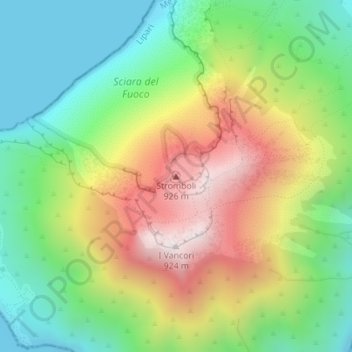
Name: Stromboli topographic map, elevation, terrain.

Location: Stromboli, Lipari, Messina, Sicily, Italy (38.79298 15.21080 38.79308 15.21090)

Average elevation: 372 m

Minimum elevation: 0 m

Maximum elevation: 914 m

Gear up for your next adventure:

🧴Bear Spray Holster - Quick-access carry for essential Canadian wilderness safety
💧Hydration Bladder - Hands-free hydration solution for long treks
🥫Freeze-Dried Meals - Lightweight, high-calorie nutrition for multi-day treks
⛺Family Camping Tent - Spacious tent suitable for family camping trips
🕶️Polarized Sunglasses - Reduces glare from snow and water at high elevations

As an Amazon Associate, this site earns from qualifying purchases at no extra cost to you.